For centuries, missionaries traveling beyond familiar borders carried more than prayer books; they brought cartographic skill and a unique eye for the unknown. Their hand‑drawn charts, compiled from oral accounts, indigenous markings, and early exploration reports, now provide hobbyists with a tangible link to places that were once truly uncharted. By studying these documents, enthusiasts can trace the evolution of geographic knowledge and uncover hidden routes, settlements, and resource sites that modern mapping often overlooks.
What Made Missionary Maps Reliable for Their Time?
Unlike early explorers who relied solely on rough sketches, missionaries spent years living among local communities. Their maps incorporated ethnographic details—river names, tribal territories, and seasonal landmarks—giving them a depth of accuracy that purely navigational charts lacked. Because missionaries were motivated to record for both spiritual outreach and logistical planning, their notes were often cross‑checked with repeated observations, resulting in surprisingly precise longitudinal and latitudinal placements.
How Can Today’s Hobbyists Use These Cartographic Treasures?
Modern hobbyists can overlay missionary maps onto current satellite imagery to identify forgotten paths or ancient trade routes. By aligning a 19th‑century missionary map of the Congo Basin with today’s GIS layers, for example, one can spot a river bend that has since vanished due to flooding or dam construction. This approach is invaluable for fieldwork planning, especially in remote areas where contemporary maps lack detail.
What Are the Key Differences Between Missionary Cartography and Contemporary GIS?
While contemporary Geographic Information Systems rely on sensor data and precision GPS, missionary charts rely on qualitative observations. This means:
- Scale Variation: Many missionary maps were drawn to a personal scale, making direct measurement difficult.
- Symbolic Representations: Indigenous landmarks are often represented with icons or descriptions rather than standardized symbols.
- Temporal Context: The maps reflect a snapshot of the landscape at a specific moment, which can be cross‑verified with historical climate records.
Despite these differences, the narratives embedded in the maps—such as seasonal migration patterns or local resource locations—provide a richer context than many digital datasets.
What Criteria Should Guide Selection of a Missionary Map?
- Authorship Credibility: Maps produced by well‑documented missionaries (e.g., William Clark or John McDouall Stuart) tend to have higher fidelity.
- Geographic Relevance: Choose maps that cover the specific region of interest, preferably with multiple copies for cross‑comparison.
- Condition of the Document: Paper integrity and legibility affect usability; high‑resolution scans mitigate loss of detail.
- Accompanying Notes: Supplementary field notes can clarify ambiguous symbols or coordinate references.
Using these criteria ensures that the chosen map delivers both historical insight and practical utility.
What Are Real‑World Scenarios Where These Maps Shine?
Field Reconnaissance in Remote Regions—When navigating the Amazon’s lesser‑charted tributaries, a hobbyist can consult early 20th‑century missionary charts to anticipate river confluences that satellite imagery has blurred due to dense canopy cover.
Genealogical Research—Descendants tracing ancestral migration routes often find that missionary maps mark settlement clusters or burial sites that modern census maps omit.
Archaeological Surveys—Archaeologists using these maps have identified potential dig sites along abandoned caravan paths in the Sahara, where contemporary maps lack the granularity to indicate historical habitation.
What Are the Implications for Future Hobbyist Exploration?
Integrating historic missionary cartography into modern exploration workflows not only enriches the narrative of a journey but also fills gaps left by satellite data. By combining qualitative historical context with quantitative GIS tools, hobbyists can craft more informed expedition plans, uncover forgotten cultural landscapes, and contribute to the preservation of intangible heritage.
As the digital age advances, the humble missionary map remains a powerful reminder that the most uncharted lands may already be mapped—if only we know where to look.
Automated Managed Pressure Drilling | Process Engineering | Memorial
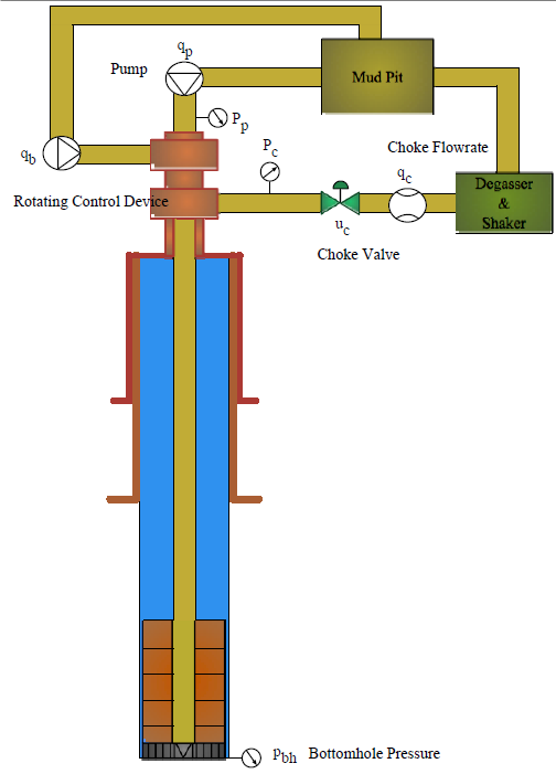
Automated Managed Pressure Drilling | Process Engineering | Memorial ...
Principles Of PID Control And Tuning | Eurotherm By Schneider Electric
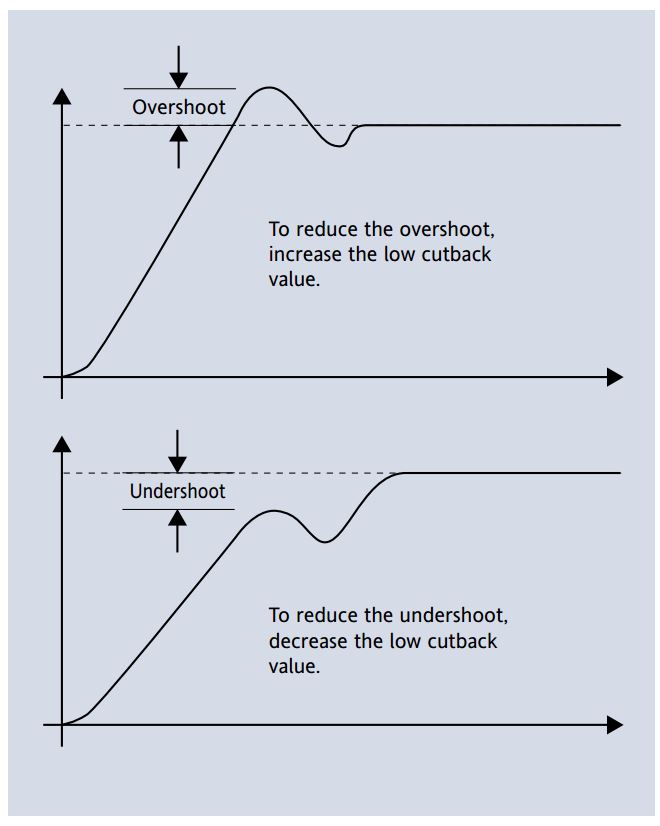
Principles of PID Control and Tuning | Eurotherm by Schneider Electric
11 Things All Drilling And Completion Engineers Need To Know About MPD
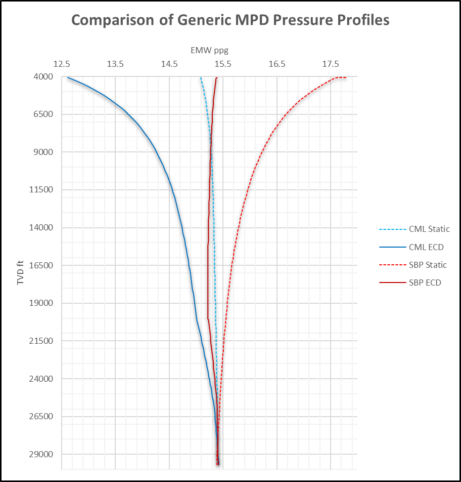
11 Things All Drilling and Completion Engineers Need to Know About MPD
Common Terminology And Definitions For Digital I/O And Logic Analyzers
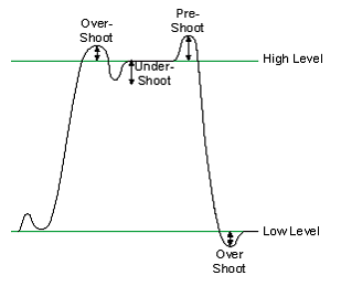
Common Terminology and Definitions for Digital I/O and Logic Analyzers ...
Auto-tuning PID Control In A PLC | Eurotherm Limited

Auto-tuning PID Control in a PLC | Eurotherm Limited